The three maps below were all sketched by Joseph Elmer Rhodes to
accompany his essays about our family history.
(640×953)
|
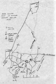
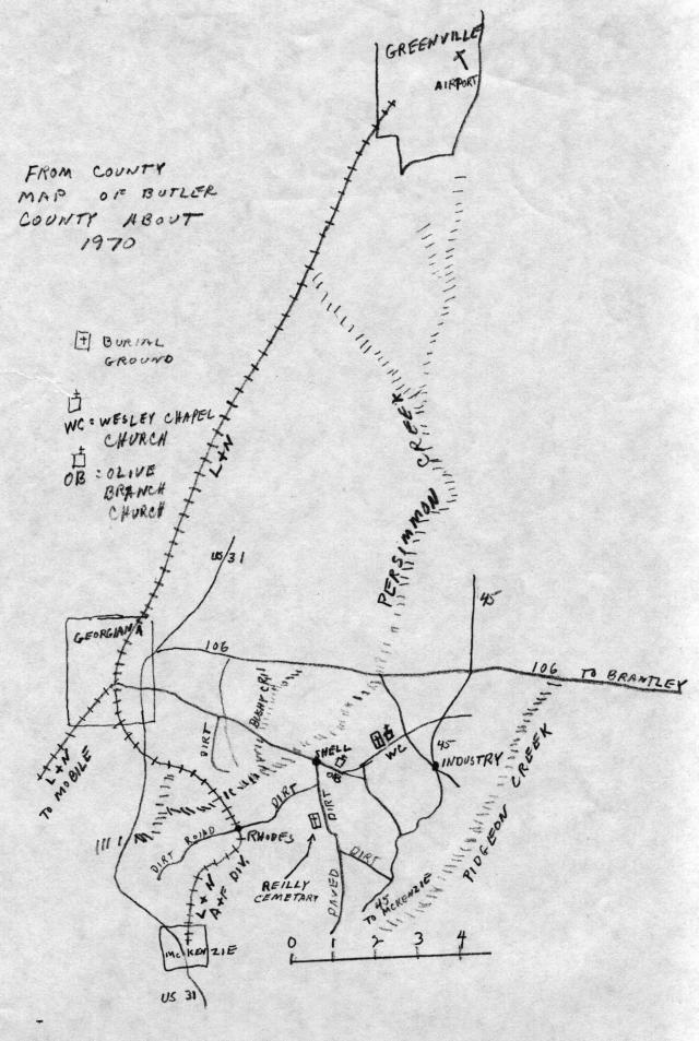
This map shows where Shell, Alabama — the town in
which the early Rhodes and their mill prospered — lies
with respect to some larger Alabama communities around it. The
state capitol, Montgomery, lies about fifty miles north of
Greenville along Interstate 65, while Georgiana and Greenville
themselves are separated by about fifteen miles. The mill was
located where Persimmon Creek crosses the road beside Shell. When
its dam was still intact, the mill pond extended north of the road
into the empty lands upstream which were, over many decades,
stripped of their virgin timber.
You may also want to refer to a
topological map of this area which includes Georgiana to the
northwest (upper left) and Shell near its center.
|
(640×748)
|
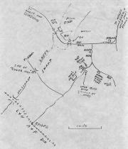
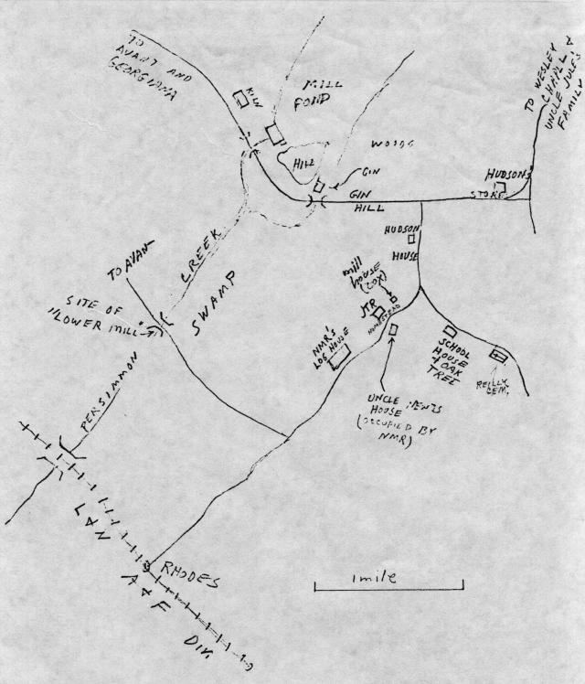
This map shows the arragement of Shell itself when its was
inhabited. To the northeast lies the Wesley Chapel, which was built
with lumber from the Rhodes Mill. The mill community itself covered
the crown of the hill, and our family's houses were located along
the dirt roads that lead south from Shell. One of these passes the
Riley Cemetery at the center of the map, where many of the Rhodes -
including Newton Marion - are buried, and where their tombstones
can still be found.
You can also examine a
topological map of this area. Note the rail siding named
“Rhodes” in the southwest corner.
|
(778×640)
|
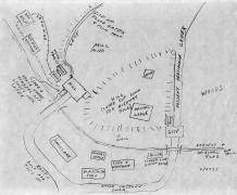
Finally, Elmer Rhodes prepared this detailed diagram of how the
mill and its buildings nestled around the hill which briefly splits
Persimmon Creek into two branches. Next to the mill are two
buildings whose labels may be difficult to read; they are the
“Boiler Room” for the steam power used in the mill's
last years, and the “Edgers” which prepared
boards. |